

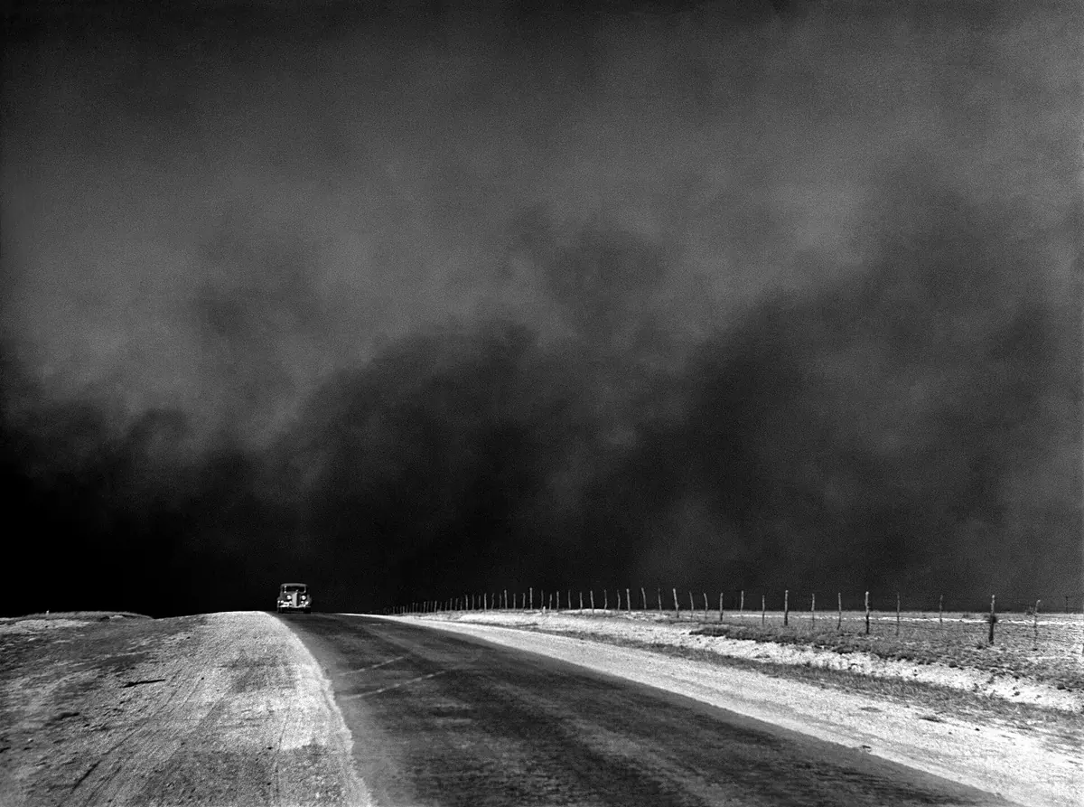
Where the Dust Bowl occurred and how long it lasted
The core Dust Bowl region included parts of western Kansas, southeastern Colorado, northeastern New Mexico, and the Oklahoma and Texas panhandles. Drought affected a much wider area, while airborne dust could travel far beyond its source. A map of storms, a map of agricultural losses and a map of migration therefore need not have identical boundaries. The label Great Plains identifies a region; it does not imply that every farm within it experienced the same degree of damage.
This was not one uninterrupted drought with an identical course everywhere. Successive episodes of deficient rainfall occurred through the 1930s and into the following decade, leaving limited opportunities for recovery between them. A timeline should therefore distinguish the extended crisis from particular events, rather than assign one precise starting and finishing day to the whole disaster. Improved weather did not immediately restore lost property or return the soil already blown from a field. Environmental recovery and the recovery of household finances operated on different timescales.134
Why more prairie was converted to cropland
Demand for wheat during the First World War and the development of machinery encouraged cultivation to expand. Ploughing removed the natural vegetation cover from additional areas. When prices subsequently fell, some producers tried to maintain income through a larger cultivated acreage and a greater harvest. Planting another field could appear to offer a way to meet payments, even while increasing the farm’s exposure to an unfavourable season.
This history should not become a simple accusation that farmers lacked knowledge. Available information, earlier favourable years, equipment costs and market pressure all mattered. An indebted farm faced different possibilities for reducing production from one with financial reserves. Over the longer term, the expectation that cultivation could keep expanding encountered the region’s variable climate. Agricultural expansion created vulnerability, but it does not by itself explain the timing or course of every drought. Decisions that appeared workable under one set of conditions could prove damaging when rainfall, prices and credit changed together.215
How wind turned exposed soil into airborne dust
Plants protect the surface through their roots, their cover and their effect on airflow close to the ground. When drought restricts growth and soil remains loose and exposed, strong winds can move particles more readily. Some material rolls or hops close to the surface; finer particles can become suspended and travel considerable distances. Impacts from moving grains further disturb the surface and damage young plants. A field can consequently lose both its protective cover and part of the material needed to support the next crop.
A dust storm was the visible expression of the loss of a productive resource. Erosion removed surface material together with some organic matter and nutrients, while deposited sediment could bury other fields, roads and buildings. Soils did not respond identically: composition, moisture, structure and cover affected their vulnerability. The catastrophe resulted from interactions between wind, drought and land use. Neither attributing everything to the weather nor claiming that farmers themselves caused the absence of rain adequately explains that interaction. The distinction matters because it identifies what conservation could change and what it could not.89
14 April 1935: Black Sunday
One of the most widely remembered storms occurred on Black Sunday, 14 April 1935. A front carrying strong winds drove dust across the High Plains and caused visibility to collapse. Conditions were particularly severe in the Oklahoma and Texas panhandles. A bright afternoon could rapidly become intensely dark. Meteorological records make it possible to follow the event from town to town, rather than treating every photograph of a 1930s dust storm as an image of that single day.
Black Sunday helped popularise the name Dust Bowl, associated with a report by journalist Robert Geiger. It became a symbol of the wider crisis, although it was neither its beginning nor its only dangerous storm. The event also mattered because of its communicative force: audiences outside the region could see that soil loss was not an abstract technical issue. Dust crossed farm and state boundaries, linking local land management to transport safety, health and the operation of communities. The dramatic day belongs within the longer process of degradation and hardship, rather than standing in for it.3
Homes, farms and the decision to leave
Harvest losses coincided with unemployment, falling prices and credit problems during the Great Depression. A family could lose income from its fields while opportunities to find work elsewhere also contracted. Dust entered buildings, disrupted everyday activities and created health hazards. The effects extended beyond landowners: agricultural workers, traders and local institutions also depended on the farm economy. Keeping a holding in operation could require public assistance and changes in how the household organised its labour.
Some residents left, including for California; others remained or moved shorter distances. Not every migrant from an affected state came from the narrowly defined core of the Dust Bowl. State-level migration totals cannot therefore be treated as the number of families displaced by particular dust storms. Departure did not guarantee stability either: people seeking work encountered competition, inadequate housing and hostility. A migration map needs an account of both economic and environmental pressures, rather than simply an arrow from drought to a new destination. Remaining in place was also an experience requiring explanation, resources and adaptation.613
1933–1935: soil conservation becomes a public responsibility
Efforts to address erosion were already developing before the most famous storms. The Soil Erosion Service was established in September 1933 under Hugh Hammond Bennett. Demonstration projects aimed to show how losses could be reduced on land actually used for agriculture. The programme nevertheless raised questions of authority: who could work on private land, how should projects be funded, and how could research be connected to the everyday decisions of farming households? Institutional arrangements mattered alongside technical knowledge.
On 27 April 1935 legislation established the Soil Conservation Service as a permanent agency within the US Department of Agriculture. This was an important part of the New Deal, but it was not one decision that miraculously ended drought. The agency developed research, technical assistance and cooperation with landholders. The later organisation of local soil conservation districts helped coordinate action across neighbouring farms. Erosion ignored property lines, so the work of an individual farmer could be insufficient to address a landscape-wide problem. Public intervention expanded the scale at which protection could be planned and supported.45
Crop strips, protective cover and shelterbelts
Soil protection involved a set of practices suited to local conditions: maintaining plant cover, altering the arrangement of crops, restoring permanent grassland on some areas and shortening stretches of ground exposed to erosive winds. Not every technique addressed the same process. Contour cultivation was especially connected with water moving over slopes, whereas strips across prevailing winds helped limit the movement of soil through the air. Distinguishing these mechanisms prevents conservation from becoming an unexplained list of agricultural improvements.
The Prairie States Forestry Project established belts of trees and shrubs to reduce wind exposure and help protect fields, livestock and farmsteads. Planting trees did not instantly bring rain; the protective mechanism involved changing airflow and required time for vegetation to grow. Surviving plans of Nebraska plantings from 1935–1942 were later converted into spatial data. They allow researchers to investigate where these investments were made and compare their subsequent condition with later aerial imagery. A conservation programme can thus be studied through its physical traces, as well as through legislation and administrative reports.8974
What changed, and what it means to say the crisis ended
Improvement reflected a combination of more favourable weather, changes in practice, public assistance and economic recovery. The entire outcome cannot be credited to one technique or one statute. Returning rain allowed vegetation to grow, but lost soil remained a loss, and a family that had moved away did not necessarily return. The end of the most acute regional crisis and the recovery of a particular farm were different processes. They did not always fit within the same range of dates or leave equally visible evidence.
The Dust Bowl reinforced the understanding of soil as a resource requiring long-term protection, rather than merely the surface supporting the next harvest. Weather observations, erosion maps, institutional records, photographs and family histories all contribute to its study. A photograph conveys experience powerfully but does not itself measure the area damaged; an agency report documents action but must be compared with its results. Bringing these forms of evidence together reveals how climate, economic conditions and land-use decisions shaped agricultural communities. It also explains why the history of conservation extends well beyond the moment when the dust clouds disappeared.4567
Questions and answers
Was the Dust Bowl a single dust storm?
No. The name refers to a prolonged catastrophe associated with drought and erosion during the 1930s. Black Sunday, 14 April 1935, was one of the period’s most famous individual events.13
Sources
- National Drought Mitigation Center, University of Nebraska–Lincoln (n.d.). The Dust Bowl
- Kansas Historical Society (2003; updated 2016). Dust Bowl
- NOAA National Weather Service, Norman (n.d.). The Black Sunday Dust Storm of April 14, 1935
- USDA Natural Resources Conservation Service (n.d.). NRCS History
- Douglas Helms, USDA Natural Resources Conservation Service (2010). Hugh Hammond Bennett and the Creation of the Soil Conservation Service, September 19, 1933 – April 27, 1935
- Abraham Parrish, Library of Congress (2023). Climate Migrants of the 1930’s Dust Bowl
- Richard Carman and Todd A. Kellerman; USDA Forest Service Research Data Archive (2021; metadata updated 2024). Nebraska windbreaks original plantings (1935–1942) CC0
- USDA Natural Resources Conservation Service (2024). Rangeland Soil Quality: Wind Erosion
- USDA Natural Resources Conservation Service (n.d.). Field Windbreak
Approximate dates (c.) describe the nature of the evidence: archaeology dates settlements, layers and remains, not single moments of invention.