

Key dates
- Third century BCE–second century CEProsperous incense commerce links Negev towns with routes towards the Mediterranean.2
- Fourth–sixth centuries CECultivation and wine production connected with Mediterranean trade expand.8
- Around the mid-sixth century CEElusa’s refuse record indicates the end of organised disposal, signalling a change in urban functioning.9
- Later sixth–early seventh centuriesDated pigeon bones indicate the winding down of the investigated pigeon towers.10
- Seventh–eleventh centuries CESome fields and terraced systems remain in use during the Early Islamic period.5
A landscape with more than one chronology
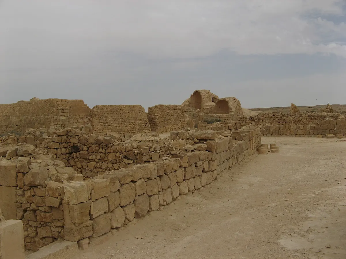
Haluza, Mamshit, Avdat and Shivta belong to the group of places associated with the Incense Route. Their surviving water installations and agricultural surroundings demonstrate that the towns did not operate separately from their hinterlands. Trade required food, water and people able to maintain settlements. This connection does not mean that every terrace wall visible today belongs to the earliest prosperity of caravan commerce. The landscape was repeatedly modified, while the functions of routes, settlements and farms changed with the economy of the region.
Tali Erickson-Gini challenged the automatic attribution of all these installations to the Nabataeans. She highlighted the use of spring water in their early agriculture and the particular importance of Late Antiquity for the expansion of runoff farming. The principal framework here is therefore the fourth to seventh centuries CE, with attention to earlier foundations and later continuity. A defensible chronology requires the dating of individual fields and installations. The name of a familiar civilisation may help readers find a subject, but it must not substitute for archaeological evidence about a particular structure.21
Catchment, conveyance and the receiving field
Runoff harvesting exploited the difference between the area receiving rainfall and the surface selected for cultivation. Water moving across slopes and temporary stream channels could be intercepted and distributed over lower fields. Terrace walls reduced the gradient and helped retain water and sediment. A section of valley consequently received some of the resources arriving from its wider surroundings. No new water was created: farmers changed its route, the time it remained in a useful location and its availability to growing plants.
An explanatory model can distinguish three elements: a catchment producing runoff, a channel or other means of directing it, and a cultivated terrace where moisture could remain in the soil. Actual farms combined these functions in different ways according to the terrain. An inadequate inflow failed to meet needs, while a sudden excess could damage the field. A diagram therefore represents relationships rather than an engineering design or a reconstruction of one excavated plot. A shared name for the technique does not imply that every ancient farm had an identical physical arrangement.312
Cultivation depended on maintaining infrastructure
Building a wall did not complete the work. Runoff deposited fine material, but successive flows could also erode soil and damage structures. Farmers had to observe the behaviour of water, remove obstructions and repair failures. Sediment research at Horvat Haluqim showed that terraced fields were simultaneously places of soil accumulation and modification by cultivation and soil organisms. The absence of clearly preserved thin sediment layers therefore does not demonstrate that runoff failed to deposit material. Later processes could erase the original appearance of that record.
The observation matters beyond excavation technique. A field was the outcome of repeated work, not simply a structure inherited from ancestors. Interrupting maintenance could alter farming conditions before a settlement was wholly abandoned. Repairs could also bring older installations back into use. A wall fragment, the sediment behind it and plant remains might consequently provide different answers because they date different processes. A single date need not describe the entire operating life of a plot or every stage of its development. Reading the landscape requires distinguishing construction, use, repair and subsequent disturbance.45
Water shortage was not the only constraint
Pigeon towers formed part of the agricultural landscape around Shivta. Investigation of their interiors included dung, plant remains, bones and nesting material. These findings support an interpretation of pigeon keeping as part of a system supplying manure to fields. Desert farming thus becomes more than a history of walls and channels. Water, nutrients, crops and animals formed an interconnected arrangement. Improving one component did not remove all the other constraints on production, and an irrigation structure alone cannot explain how an entire farm operated.
Microscopic examination of refuse from Shivta, Elusa and Nessana also reveals different ways of using livestock dung. Material valuable as fertiliser could serve as fuel, while its appearance in refuse depended on local decisions. Historians should not assume that everything absent from rubbish was absent from the farm. A resource used effectively can leave a weaker disposal signature than one discarded. Waste analysis makes it possible to ask specific questions about competing demands for fuel and soil fertility, and about the organisation of animal management. These questions connect the field with activities inside the settlement.67
Vineyards connected the desert with distant markets
Two categories of finds proved particularly important in research on the Late Antique Negev: grape pips and fragments of transport vessels. Daniel Fuks and colleagues reconstructed an expansion of viticulture and its connections with Mediterranean trade during the fourth to sixth centuries. Combining materials from related archaeological contexts is more informative than finding a winepress alone. An installation demonstrates a capacity to process a crop, but cannot by itself establish how intensively people used it in every successive generation. Production and commerce require related yet distinct bodies of evidence.
The growing importance of a marketable product changed the economic calculation of farming. Maintaining vines made sense when their harvest could be processed, placed in suitable containers and passed to buyers. This is an interpretation of economic dependence, not a surviving balance sheet belonging to a named farmer. Production for distant markets could create opportunities while connecting the fate of a field with circumstances beyond the desert. Walls and channels might remain functional even when sales became difficult. A history of this economy must therefore follow both the movement of water and the movement of goods.82
Decline had neither one date nor one explanation
Research on Elusa’s rubbish mounds indicates an end to organised refuse removal around the middle of the sixth century. This identifies a change in urban functioning rather than automatically dating the departure of the last inhabitant. Separate analysis of dated bones from pigeon towers identified the winding down of their use in the Late Byzantine period. Different kinds of evidence thus illuminate changes in economic and settlement organisation. There is no requirement to assume that every component stopped operating on the same day or for the same immediate reason.
Interpretations consider changes in demand, political conditions, epidemics and climate. Isotopic research on Negev animals did not support a simple picture of an earlier “green desert” suddenly drying out at the transition to the Islamic period. Other studies discuss sixth-century climatic and economic pressures. Each finding must be read within the limits of its samples, locations and chronological coverage. Coinciding with a major historical event does not establish a local causal mechanism. A change in economic organisation can often be demonstrated more confidently than it can be assigned a single, exclusive cause.91011
Farming continued across a change of period
Optically stimulated luminescence, or OSL, has helped researchers establish the chronology of sediments in terraces at several sites. The results indicate that some extensive systems were constructed and used from the fourth into the eleventh century. This does not contradict the contraction of Late Antique wine commerce. A product or commercial network could lose importance while cultivation continued on part of the agricultural land. The decline of an export economy and the disappearance of farming are therefore different propositions, requiring different evidence.
Across a region, a mosaic of experiences should be expected. One settlement might lose urban functions, another change its economic emphasis, and neighbouring fields remain cultivated. The modern boundary between Byzantine and Early Islamic periods is useful for organising chronology, but does not automatically mark the end of agricultural practices. A household dependent on a field also faced questions of available labour, infrastructure, obligations and opportunities to sell produce. Reconstructing these relationships requires bringing scattered traces together rather than forcing them into one account of catastrophe. Regional continuity can coexist with considerable disruption at individual places.573
What a model explains, and what it cannot recover
Modelling of Shivta’s economy published in 2025 examined relationships between water availability, viticulture and labour costs. Its simulations show why catchment size, the course of drought and recovery of production need to be considered together. These are experiments under stated assumptions, partly informed by modern measurements and comparisons. Their outputs must not be presented as measured harvests of Byzantine farmers. A model helps test whether a proposed mechanism is internally coherent; it does not replace archaeological evidence that a particular sequence of events actually happened at the site.
The Negev’s legacy includes deliberate management of a limited and irregular resource. It also exposes the work required to maintain an agricultural landscape: a stone structure becomes part of farming through recurring labour, soil, plants and human organisation. A modern diagram of catchment, channel and terrace helps explain the relationship while remaining an illustration of a principle. The defensible historical conclusion concerns adaptation and its dependence on economic conditions. It is not a promise that all deserts can be cultivated in the same manner, or that an ancient technique eliminates the risk of drought.123
Questions and answers
Did the Nabataeans build every Negev terrace?
No. Many systems developed in Roman and Byzantine times, and some continued in use later. Individual constructions require their own dating evidence.15
Where did water for the fields come from?
Farmers intercepted part of the runoff generated by rain over a wider area and directed it towards smaller fields, increasing the moisture potentially retained in their soil.3
Sources
- Tali Erickson-Gini (2012). Nabataean agriculture: Myth and reality
- UNESCO World Heritage Centre (inscribed 2005). Incense Route – Desert Cities in the Negev
- Yoav Avni (2022). The Emergence of Terrace Farming in the Arid Zone of the Levant—Past Perspectives and Future Implications
- Hendrik J. Bruins; Toine Jongmans; Johannes van der Plicht (2020). Ancient runoff farming and soil aggradation in terraced wadi fields (Negev, Israel): Obliteration of sedimentary strata by ants, scorpions and humans
- Gideon Avni; Naomi Porat; Yoav Avni (2013). Byzantine–Early Islamic agricultural systems in the Negev Highlands: Stages of development as interpreted through OSL dating
- Jennifer Ramsay and colleagues (2016). For the birds — An environmental archaeological analysis of Byzantine pigeon towers at Shivta (Negev Desert, Israel)
- Don H. Butler and colleagues (2020). Byzantine—Early Islamic resource management detected through micro-geoarchaeological investigations of trash mounds (Negev, Israel)
- Daniel Fuks and colleagues (2020). The rise and fall of viticulture in the Late Antique Negev Highlands reconstructed from archaeobotanical and ceramic data
- Guy Bar-Oz and colleagues (2019). Ancient trash mounds unravel urban collapse a century before the end of Byzantine hegemony in the southern Levant
- Xin Yan and colleagues (2021). FTIR Bone Characterization and Radiocarbon Dating: Timing the Abandonment of Byzantine Pigeon Towers in the Negev Desert, Israel
- Petra Vaiglova and colleagues (2020). Climate stability and societal decline on the margins of the Byzantine empire in the Negev Desert
- Barak Garty; Gil Gambash; Sharona T. Levy; Guy Bar-Oz (2025). Wine economy in Byzantine Shivta (Negev, Israel): Exploring the role of runoff agriculture and droughts through Agent-Based Modeling
Approximate dates (c.) describe the nature of the evidence: archaeology dates settlements, layers and remains, not single moments of invention.